|
|
|
|
|
|
| Friday 31 August |
20.66
mi |
33.25
km |
|
|
|
|
| Home to Warsash Village |
9.81
mi |
15.79
km |
|
| Via St Denys, the Itchen Boardwalk,
river path, Chapel, Itchen Bridge,
Woolston, Portsmouth Road, Pound
Road, Hamble Lane, Lowford, Lower
Swanwick, Swanwick Shore Road,
river Hamble footpath and causeway,
Passage lane and Warsash Clock
Tower. |
|
| Warsash Village to Warsash
Ferry |
2.18 mi |
3.51 km |
|
| Down Newtown Road, Hook Park
Road and through the nature reserve
to the beach for a short break
and a drink then along the footpath
to Shore Road and the ferry to
Hamble. |
|
| Hamble Quay to Royal Victoria
Country Park |
2.88 mi |
4.63 km |
|
| Up Green Lane and down School
Lane to Hamble Point. Along the
shore to the country park and
round the park to the cafe for
a break. |
|
| Royal Victoria Country
Park to Hamble Station |
1.33
mi |
2.14 km |
|
| Out to Hound Road, Hamble Lane
and Hamble station for the train
home. |
|
|
|
| Finding the next train cancelled,
continued along Hamble Lane to
the recreation ground. Down the
path to the country park and across
the park to Victoria Road. Up
Station Road, St Marys Road, Hound
Way and Hound Road. Along Hamble
Lane to Hamble station, then along
the Rail Trail footpaths to Hound
Road, the footpath to The Badgers
and Netley station. |
|
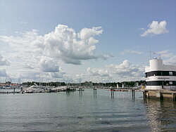
| The day started cloudy but the
sun came out when I arrived at
Warsash beach and it remained
sunny. |
|
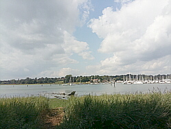
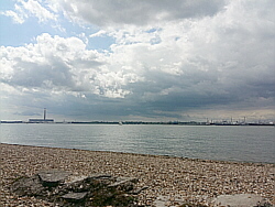
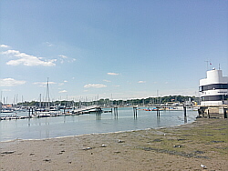
| Top Photo:
River Hamble near Swanwick Shore
Road. |
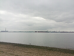
| Bottom Photo:
Warsash beach. |
|
|
|
|
|
 |
|
| Wednesday 29 August |
12.89
mi |
20.74
km |
|
|
|
|
| Home to Hamble Square |
7.79
mi |
12.54
km |
|
| Via St Denys, Horseshoe Bridge,
Itchen Boardwalk, Itchen footpath,
under Northam Bridge, Chapel,
Itchen Bridge, Woolston, Weston
Shore, Netley, Royal Victoria
Country Park and Hamble Lane. |
|
| Hamble Square to Royal
Victoria Country Park |
2.89
mi |
4.65
km |
|
| Down to Hamble Quay for a break
and a drink by the river. Up Green
Lane and down School Lane to Hamble
Point. Along the shore and round
the country park to the cafe. |
|
| Royal Victoria Country
Park to Netley Station |
2.21
mi |
3.56
km |
|
| Out to Hound Road, Hamble Lane,
Hamble station, along the Rail
Trail footpath to Hound Road then
the footpath to The Badgers and
Netley station. |
|
| A mostly cloudy afternoon with
a few sunny spells. |
|
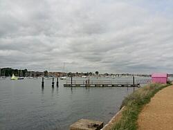
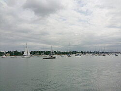
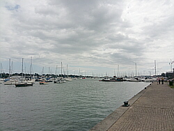
| Photo: Hamble
Quay. |
|
|
|
|
|
|
|
|
| Tuesday 28 August |
23.60
mi |
37.98
km |
|
|
|
|
| Home to Titchfield |
11.57
mi |
18.62
km |
|
| Via St Denys Road, Cobden Bridge,
Bullar Road, Bitterne Road, Northam
Bridge, Chapel, Itchen Bridge,
Woolston, Portsmouth Road, Pound
Road, Hamble Lane, Lowford, Lower
Swanwick, Park Gate and Southampton
Road Retail Park. |
|
| Titchfield to Warsash
Village |
3.30
mi |
5.31
km |
|
| South Street, Coach Hill, Common
Lane and Warsash Road. |
|
| Warsash Village to Warsash
Ferry |
2.23
mi |
3.59
km |
|
| Down Newtown Road, Hook Park
Road and through the nature reserve
to the beach for a short break
then along the footpath to Shore
Road and the ferry to Hamble. |
|
| Hamble Quay to Royal Victoria
Country Park |
2.95
mi |
4.75
km |
|
| Up to Hamble Square then School
Lane, Hamble Point, Hamble Shore
to the country park. A break by
the shore then round to the park
cafe for a drink. |
|
| Royal Victoria Country
Park to Hamble Station |
3.55
mi |
5.71
km |
|
| Out to Hamble Lane then along
Hamble Lane, Hound Road, Hound
Way, St Marys Road, Station Road
(Netley station), The Badgers,
the footpath and across Hound
Road, the Rail Trail to Hamble
Lane (by the police HQ entrance)
and along Hamble Lane to Hamble
station. |
|
| Mostly cool and cloudy, a little
brightness at times. |
|
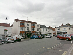
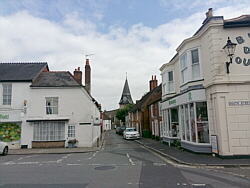
| Top Photo:
Titchfield. |
| Bottom Photo:
Warsash, the ferry pontoon. |
|
|
|
|
|
 |
|
| Saturday 25 August |
15.46
mi |
24.88
km |
|
|
|
|
| Home to Warsash Village |
9.57
mi |
15.40
km |
|
| Via St Denys, the Itchen Boardwalk,
river path, Chapel, Itchen Bridge,
Woolston, Portsmouth Road, Pound
Road, Hamble Lane, Lowford, Lower
Swanwick and Sarisbury Green to
Warsash Clock Tower. |
|
| Warsash Village to Warsash
Ferry |
0.52
mi |
0.84
km |
|
| Down Shore Road to the harbour
by the Rising Sun and along the
footpath to the Hamble ferry.
|
|
| Hamble Quay to Royal Victoria
Country Park |
2.89
mi |
4.65
km |
|
| Up to Hamble Square then down
School Lane to Hamble Point, along
the shore to the country park.
Round to the cafe for a drink. |
|
| Royal Victoria Country
Park to Netley Station |
2.48
mi |
3.99
km |
|
| Out to Hamble Lane then Hound
Road, Hound Way, St Marys Road
and Station Road to Netley station
for the train home. |
|
| Cool, sunny spells. |
|
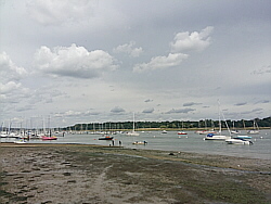
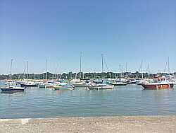
| Photo: Warsash
harbour. |
|
|
|
|
|
 |
|
| Wednesday 22 August |
17.80
mi |
28.65
km |
|
|
|
|
| Home to Warsash Village |
9.54
mi |
15.35
km |
|
| Via St Denys, the Itchen Boardwalk,
river path, Chapel, Itchen Bridge,
Woolston, Portsmouth Road, Pound
Road, Hamble Lane, Lowford, Lower
Swanwick and Sarisbury Green to
Warsash Clock Tower. |
|
| Warsash Village to Warsash
Ferry |
2.25
mi |
3.62
km |
|
| Down Newtown Road and Hook Park
Road, along the Nature Reserve
footpath to the beach, up the
river footpath, Shore Road and
the footpath to the Hamble ferry.
|
|
| Hamble Quay to Royal Victoria
Country Park |
2.81
mi |
4.52
km |
|
| Up Green Lane then down School
Lane to Hamble Point and along
the shore to the country park.
Round to the cafe for a drink. |
|
| Royal Victoria Country
Park to Hamble Station |
3.20
mi |
5.15
km |
|
| Out to Hamble Lane then Hound
Road, Hound Way, St Marys Road
and Station Road to Netley station.
Via The Badgers, the footpath
and the Rail Trail to Hamble station
for the train home. |
|
| Cloudy and humid. |
|
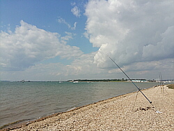
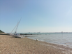
| Photo: Warsash
beach. |
|
|
|
|
|
 |
|
| Tuesday 21 August |
12.97
mi |
20.87
km |
|
|
|
|
| Home to Hamble Square |
7.82
mi |
12.59
km |
|
| Via St Denys, Horseshoe Bridge,
Itchen Boardwalk, Itchen footpath,
under Northam Bridge, Chapel,
Itchen Bridge, Woolston, Weston
Shore, Netley, Royal Victoria
Country Park and Hamble Lane. |
|
| Hamble Square to Royal
Victoria Country Park |
2.97
mi |
4.78
km |
|
| Down to Hamble Quay for a break
and a drink by the river. Up Green
Lane and through Hamble Common
to Hamble Point. Along the shore
and round the country park to
the cafe. |
|
| Royal Victoria Country
Park to Netley Station |
2.18
mi |
3.51
km |
|
| Out to Hound Road, Hamble Lane,
Hamble station, along the Rail
Trail footpath to Hound Road then
the footpath to The Badgers and
Netley station. |
|
| A sunny afternoon with almost
cloudless skies. |
|
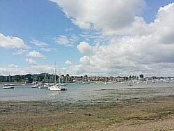
| Photo: Hamble
Shore near the country park. |
|
|
|
|
|
 |
|
| Friday 17 August |
12.87
mi |
20.71
km |
|
|
|
|
| Home to Hamble Square |
7.77
mi |
12.50
km |
|
| Via St Denys, Horseshoe Bridge,
Itchen Boardwalk, Itchen footpath,
under Northam Bridge, Chapel,
Itchen Bridge, Woolston, Weston
Shore, Netley, Royal Victoria
Country Park and Hamble Lane. |
|
| Hamble Square to Royal
Victoria Country Park |
2.90
mi |
4.67
km |
|
| Down to Hamble Quay for a break
and a drink by the river. Up Green
Lane and through Hamble Common
to Hamble Point. Along the shore
and round the country park to
the cafe. |
|
| Royal Victoria Country
Park to Netley Station |
2.20
mi |
3.54
km |
|
| Out to Hound Road, Hamble Lane,
Hamble station, along the Rail
Trail footpath to Hound Road then
the footpath to The Badgers and
Netley station. |
|
| Cool and cloudy, some sun later
in the afternoon. |
|
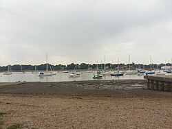
| Photo: Hamble
Quay. |
|
|
|
|
|
|
|
|
| Wednesday 15 August |
20.52
mi |
33.02
km |
|
|
|
|
| Home to Titchfield |
11.16
mi |
17.96
km |
|
| Via St Denys, the Itchen Boardwalk,
river path, Chapel, Itchen Bridge,
Woolston, Portsmouth Road, Pound
Road, Hamble Lane, Lowford, Lower
Swanwick and Park Gate. |
|
| Titchfield to Warsash
Village |
3.25
mi |
5.23
km |
|
| A drinks break in Titchfield
then Coach Hill, Common Lane and
Warsash Road. |
|
| Warsash Village to Warsash
Ferry |
0.53
mi |
0.85
km |
|
| Down Shore Road for a short
break by the river then along
the footpath to the ferry. |
|
| Hamble Quay to Royal Victoria
Country Park |
3.78
mi |
6.08
km |
|
| Up to Hamble Lane then Hound
Road, Hound Way, St Marys Road,
Station Road and Victoria Road.
Into the country park and along
the shore to the pier. Very windy
on the shore. |
|
| Royal Victoria Country
Park to Hamble Station |
1.80
mi |
2.90
km |
|
| Round the end of the park to
the cafe for a break. The sun
came out. From the cafe out to
Hound Road then a jog down the
Rail Trail footpath to Hamble
station. With a few spare minutes,
continued along Hamble Lane to
the traffic island by the police
headquarters, crossed the road
and returned to the station. |
|
| Mostly cloudy, breezy on the
river and the shore. |
|
| Top Photo:
Titchfield. |
| Bottom Photo:
Warsash. |
|
|
|
|
|
 |
|
| Tuesday 14 August |
12.98
mi |
20.89
km |
|
|
|
|
| Home to Hamble Square |
7.80
mi |
12.55
km |
|
| Via St Denys, Horseshoe Bridge,
Itchen Boardwalk, Itchen footpath,
under Northam Bridge, Chapel,
Itchen Bridge, Woolston, Weston
Shore, Netley, Royal Victoria
Country Park and Hamble Lane. |
|
| Hamble Square to Royal
Victoria Country Park |
2.97
mi |
4.78
km |
|
| Down to Hamble Quay for a break
and a drink by the river. Up Green
Lane and down School Lane to Hamble
Point. Along the shore and round
the country park to the cafe. |
|
| Royal Victoria Country
Park to Netley Station |
2.21
mi |
3.56
km |
|
| Out to Hound Road, Hamble Lane,
Hamble station, along the Rail
Trail footpath to Hound Road then
to The Badgers and Netley station. |
|
| Cloudy start, sunny intervals
later. Breezy. |
|
| Photo: Hamble
Quay. |
|
|
|
|
|
 |
|
| Monday 13 August |
17.29
mi |
27.83
km |
|
|
|
|
| Home to Warsash Village |
9.60
mi |
15.45
km |
|
| Via St Denys, the Itchen Boardwalk,
river path, Chapel, Itchen Bridge,
Woolston, Portsmouth Road, Pound
Road, Hamble Lane, Lowford, Lower
Swanwick and Sarisbury Green to
Warsash Clock Tower. |
|
| Warsash Village to Warsash
Ferry |
2.19
mi |
3.52
km |
|
| Down Newtown Road and Hook Park
Road, along the Nature Reserve
footpath to the beach, up the
river footpath, Shore Road and
the footpath to the Hamble ferry.
|
|
| Hamble Quay to Royal Victoria
Country Park |
3.04
mi |
4.89
km |
|
| Up to Hamble Square then down
School Lane to Hamble Point, along
the shore and (being a spring
tide the beach became impassable)
along the path into the country
park. Down to the shore for a
break then round to the cafe for
a drink. |
|
| Royal Victoria Country
Park to Netley Station |
2.46
mi |
3.96
km |
|
| Out to Hamble Lane then Hound
Road, Hound Way, St Marys Road
and Station Road to Netley station
and the train home. |
|
| Cool, mostly cloudy with some
good sunny spells. |
|
| Photo: Warsash
beach. |
|
|
|
|
|
 |
|
| Thursday 9 August |
13.07
mi |
21.03
km |
|
|
|
|
| Home to Hamble Square |
7.76
mi |
12.49
km |
|
| Via St Denys, Horseshoe Bridge,
Itchen Boardwalk, Itchen footpath,
under Northam Bridge, Chapel,
Itchen Bridge, Woolston, Weston
Shore, Netley, Royal Victoria
Country Park and Hamble Lane. |
|
| Hamble Square to Royal
Victoria Country Park |
3.08
mi |
4.96
km |
|
| Down to Hamble Quay for a break
and a drink by the river. Up to
Green Lane and down School Lane
to Hamble Point. Along the shore
and round the country park to
the cafe. |
|
| Royal Victoria Country
Park to Netley Station |
2.23
mi |
3.59
km |
|
| Out to Hound Road, Hamble Lane,
Hamble station, along the Rail
Trail footpath to Hound Road then
to The Badgers and Netley station. |
|
| Cool and cloudy until mid afternoon
when the sun came out. |
|
| Photo: Hamble
Quay. |
|
|
|
|
|
 |
|
| Wednesday 8 August |
16.89
mi |
27.18
km |
|
|
|
|
| Home to Warsash Village |
9.85
mi |
15.85
km |
|
| Via St Denys, the Itchen Boardwalk,
river path, Chapel, Itchen Bridge,
Woolston, Portsmouth Road, Pound
Road, Hamble Lane, Lowford, Lower
Swanwick, Swanwick Shore Road,
river Hamble footpath and causeway,
Passage lane and Warsash Clock
Tower. |
|
| Warsash Village to Warsash
Ferry |
2.27
mi |
3.65
km |
|
| Down Newtown Road and Hook Park
Road, along the Nature Reserve
footpath to the beach, up the
river footpath, Shore Road and
the footpath to the Hamble ferry.
|
|
| Hamble Quay to Royal Victoria
Country Park |
2.84
mi |
4.57
km |
|
| Up Green Lane, through Hamble
Common to Hamble Point, along
the shore to the country park
and round the park to the cafe. |
|
| Royal Victoria Country
Park to Hamble Station |
1.93
mi |
3.11
km |
|
| Out to Hound Road then Hound
Way, Station Road, The Badgers
and the Rail Trail footpath to
Hamble station for the train home. |
|
| A cooler day, cloudy at times
but good sunny spells. Very windy. |
|
| Photo: Hamble
from the Warsash side of the river. |
|
|
|
|
|
 |
|
| Tuesday 7 August |
14.50
mi |
23.34
km |
|
|
|
|
| Home to Hamble Square |
7.75
mi |
12.47
km |
|
| Via St Denys, Horseshoe Bridge,
Itchen Boardwalk, Itchen footpath,
under Northam Bridge, Chapel,
Itchen Bridge, Woolston, Weston
Shore, Netley, Royal Victoria
Country Park and Hamble Lane. |
|
| Hamble Square to Royal
Victoria Country Park |
4.57
mi |
7.35
km |
|
| Down to Hamble Quay for a short
break. Back up to Hamble Square
then Hamble Lane, Hound Road,
Hound Way, Station Road, Victoria
Road and the shore in the country
park. Across the country park
to the cafe. |
|
| Royal Victoria Country
Park to Netley Station |
2.18
mi |
3.51
km |
|
| Out to Hamble Lane, Hamble station,
along the rail trail footpath
to Hound Road then the footpath,
The Badgers and Netley station. |
|
| A humid afternoon with outbreaks
of light rain. Breezy at times. |
|
| Photo: Hamble
Quay. |
|
|
|
|
|
 |
|
| Monday 6 August |
17.33
mi |
27.89
km |
|
|
|
|
| Home to Warsash Village |
9.83
mi |
15.82
km |
|
| Via St Denys, the Itchen Boardwalk,
river path, Chapel, Itchen Bridge,
Woolston, Portsmouth Road, Pound
Road, Hamble Lane, Lowford, Lower
Swanwick, Swanwick Shore Road,
river Hamble footpath and causeway,
Passage lane and Warsash Clock
Tower. |
|
| Warsash Village to Warsash
Ferry |
2.28
mi |
3.67
km |
|
| Down Newtown Road and Hook Park
Road, along the Nature Reserve
footpath to the beach, up the
river footpath, Shore Road and
the footpath to the Hamble ferry.
|
|
| Hamble Quay to Royal Victoria
Country Park |
3.01
mi |
4.84
km |
|
| Up to Hamble Square and down
School Lane to Hamble Point. Along
the shore to the country park
and round the park to the cafe. |
|
| Royal Victoria Country
Park to Netley Station |
2.21
mi |
3.56
km |
|
| Out to Hound Road, Hamble Lane,
Hamble station, along the rail
trail footpath to Hound Road then
to The Badgers and Netley station. |
|
| Another very warm day with a
refreshing breeze along the shore. |
|
| Photo: The
footbridge along the Hamble river
causeway. |
|
|
|
|
|
 |
|
| Friday 3 August |
12.93
mi |
20.81
km |
|
|
|
|
| Fareham Station to Titchfield |
2.08
mi |
3.35
km |
|
| Train to Fareham. Along the
A27 to the Titchfield Gyratory
then Titchfield Hill, East Street,
High Street. |
|
| Titchfield to Warsash
Village |
3.26
mi |
5.25
km |
|
| Via Coach Hill, Common Lane
and Warsash Road. |
|
| Warsash Village to Warsash
Ferry |
2.23
mi |
3.59
km |
|
| Down Newtown Road and Hook Park
Road, along the Nature Reserve
footpath to the beach, up the
river footpath, Shore Road and
the footpath to the Hamble ferry.
|
|
| Hamble Quay to Royal Victoria
Country Park |
2.88
mi |
4.63
km |
|
| Up to Hamble Square and down
School Lane to Hamble Point. Along
the shore to the country park
and round the park to the cafe. |
|
| Royal Victoria Country
Park to Netley Station |
2.48
mi |
3.99
km |
|
| Along the footpath to Hamble
Lane, along Hamble Lane to Hound
Road, then Hound Way and Station
Road to Netley station for the
train home. |
|
| Another very warm day. |
|
| Photo: Shore
Road, Warsash. |
|
|
|
|
|
 |
|
| Thursday 2 August |
13.08
mi |
21.05
km |
|
|
|
|
| Home to Hamble Square |
7.80
mi |
12.55
km |
|
| Via St Denys, Horseshoe Bridge,
Itchen Boardwalk, Itchen footpath,
under Northam Bridge, Chapel,
Itchen Bridge, Woolston, Weston
Shore, Netley, Royal Victoria
Country Park and Hamble Lane. |
|
| Hamble Square to Royal
Victoria Country Park |
3.05
mi |
4.91
km |
|
| Down to Hamble Quay for a break
by the river. Back up to Hamble
Square and down School Lane to
Hamble Point. Along the shore
and across the country park to
the cafe. |
|
| Royal Victoria Country
Park to Netley Station |
2.23
mi |
3.59
km |
|
| Out to Hound Road, Hamble Lane,
Hamble station, along the rail
trail footpath to Hound Road then
the footpath, The Badgers and
Netley station. |
|
| Getting very warm again. Hardly
a cloud to be seen. |
|
| Photo: Hamble
Quay. |
|
|
|
|
|
 |
|
| Wednesday 1 August |
16.85
mi |
27.12
km |
|
|
|
|
| Home to Warsash Village |
9.59
mi |
15.43
km |
|
| Home to St Denys Road, Horseshoe
Bridge, Itchen Boardwalk and footpath,
under Northam Bridge, Chapel,
Itchen Bridge, Woolston, Portsmouth
Road, Pound Road, Hamble Lane,
Lowford, Lower Swanwick, Sarisbury
Green, Warsash Clock Tower. |
|
| Warsash Village to Warsash
Ferry |
2.19
mi |
3.52
km |
|
| Down Newtown Road and Hook Park
Road, along the Nature Reserve
footpath to the beach, up the
river footpath, Shore Road and
the footpath to the Hamble ferry.
|
|
| Hamble Quay to Royal Victoria
Country Park |
2.87
mi |
4.62
km |
|
| Up to Hamble Square and down
School Lane to Hamble Point. Along
the shore to the country park
for a break by the water and another
at the cafe. |
|
| Royal Victoria Country
Park to Netley Station |
2.20
mi |
3.54
km |
|
| Out to Hound Road, Hamble Lane,
Hamble station, along the rail
trail footpath To Hound Road and
via The Badgers to Netley station
for the train home. |
|
| A warm day but not as hot as
recently. |
|
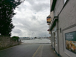
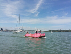
| Photo: The
Hamble-Warsash ferry. |
|
|
|
|
|
| More information and links |
|
|
|
|