|
|
|
 |
|
| Saturday 30 |
19.35
mi |
31.14
km |
|
|
|
|
| Home to Hamble Square |
8.24
mi |
13.26
km |
|
| Via St Denys Road, Cobden Bridge,
Bullar Road, Bitterne Road, Northam
Bridge, Chapel, Itchen Bridge,
Woolston, Weston Shore, Netley,
Royal Victoria Country Park and
Hamble Lane. |
|
| Hamble Square to Royal
Victoria Country Park |
2.79
mi |
4.49
km |
|
| Down to Hamble Quay for a drink
break then up Green Lane to School
Lane and Hamble Point. Along the
shore and across the country park
to the cafe. |
|
| Royal Victoria Country
Park to Home |
8.32
mi |
13.39
km |
|
| Out to Hound Road then Hamble
Lane and the A27 to Mansbridge.
Through Riverside Park to Cobden
Bridge and St Denys Road. |
|
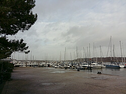
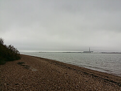
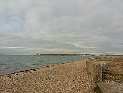
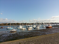
| Photo: Hamble
Quay, 30.12.17. |
|
|
|
|
|
 |
|
| Tuesday 26 |
6.96
mi |
11.20
km |
|
|
|
|
| Home to Lakeside Country
Park and |
|
|
|
| Lakeside Country Park
to Home |
6.96
mi |
11.20
km |
|
| Via Portswood Road, High Road,
Stoneham Lane, round the lakes,
Wide Lane, A27, Mansbridge, Riverside
Park, Cobden Bridge, St Denys
Road. |
| |
| |
| |
| |
| |
| |
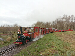
| Photo: Eastleigh
Lakeside Steam Railway "Sandy
River", 26.12.17. |
|
|
|
|
|
 |
|
| Sunday 24 |
16.25
mi |
26.15
km |
|
|
|
|
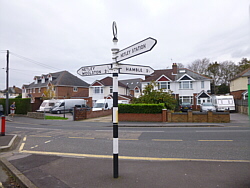
| Home to Hamble Square |
8.55
mi |
13.76
km |
|
| Via St Denys Road, Cobden Bridge,
Bullar Road, Bitterne Road, Northam
Bridge, Chapel, Itchen Bridge,
Portsmouth Road, Pound Road and
Hamble Lane. |
|
| Hamble Square to Royal
Victoria Country Park |
1.77
mi |
2.85
km |
|
| Down to Hamble Quay for a quick
drink then back up to the square,
along Hamble Lane and down the
path next to the football club
to the park cafe. |
|
| Royal Victoria Country
Park to Home |
5.93
mi |
9.54
km |
|
| Through Netley village, then
Weston Shore, Woolston, Peartree,
Athelstan Road, Bullar Road, Cobden
Bridge and St Denys Road. |
|
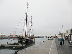
| Photo: Hamble
Quay, 24.12.17. |
|
|
|
|
|
 |
|
| Saturday 23 |
16.95
mi |
27.28
km |
|
|
|
|
| Home to Warsash Village |
9.98
mi |
16.06
km |
|
| Via St Denys Road, Cobden Bridge,
Bullar Road, Bitterne Road, Northam
Bridge, Chapel, Itchen Bridge,
Portsmouth Road, Pound Road, Hamble
Lane, Lowford, Lower Swanwick
and Sarisbury Green. |
|
| Warsash Village to Warsash
Ferry |
2.20
mi |
3.54
km |
|
| Down Newtown Road and Hook Park
Road, through the nature reserve
to the beach for a short break
and a drink. From there along
the river path to the ferry to
Hamble. |
|
| Hamble Quay to Royal Victoria
Country Park |
3.68
mi |
5.92
km |
|
| Up to Hamble Square, along Hamble
Lane, down Hound Road, Hound Way
and Station Road to Netley, along
Victoria Road and into the country
park to the pier. |
|
| Royal Victoria Country
Park to Netley Station |
1.09
mi |
1.75
km |
|
| Round the end of the park to
the cafe for a break, then out
of the park to Hound Road and
along the footpath to Netley station
for the train home. |
|
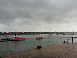
| Photo: The
beach at Warsash, 23.12.17. |
|
|
|
|
|
 |
|
| Thursday 21 |
10.88
mi |
17.51
km |
|
|
|
|
| Poole Station to Sandbanks
Ferry |
5.39
mi |
8.67
km |
|
| Shopping Centre, Poole Quay,
Baiter Park, Whitecliff, Lilliput,
Sandbanks, Ferry. |
|
| Sandbanks Ferry to Bournemouth
Pier |
4.06
mi |
6.53
km |
|
| Ferry, Sandbanks, Beach to Branksome
Chine, Bournemouth Pier. |
|
| Bournemouth Pier to Bournemouth
Station |
1.43
mi |
2.30
km |
|
| Pier, Gardens, Square, Old Christchurch
Road, Park, Dean Park Road, Station. |
| |
| |
| |
| Photo: Poole
Quay, 21.12.17. |
|
|
|
|
|
 |
|
| Wednesday 6 |
12.77
mi |
20.55
km |
|
|
|
|
| Home to Hamble Square |
8.24
mi |
13.26
km |
|
| St Denys Road, Cobden Bridge,
Bullar Road, Bitterne Road, Northam
Bridge, Chapel, Itchen Bridge,
Woolston, Weston Shore, Netley,
Royal Victoria Country Park, Hamble
Lane to Hamble Square. |
|
| Hamble Square to Royal
Victoria Country Park |
4.01
mi |
6.45
km |
|
| To Hamble Quay for a drink then
back up to Hamble Square, along
Hamble Lane, down Hound Road,
Hound Way and Station Road to
Netley, into the country park
to the pier and across the park
to the cafe. |
|
| Royal Victoria Country
Park to Netley Station |
0.52
mi |
0.84
km |
|
| Out of the park to Hound Road
and along the footpath to Netley
station for the train home. |
|
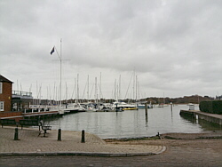
| Photo: Hamble
Quay, 06.12.17. |
|
|
|
|
|
 |
|
| Tuesday 5 |
13.23
mi |
21.29
km |
|
|
|
|
| Home to Hamble Square |
8.20
mi |
13.20
km |
|
| St Denys Road, Cobden Bridge,
Bullar Road, Bitterne Road, Northam
Bridge, Chapel, Itchen Bridge,
Woolston, Weston Shore, Netley,
Royal Victoria Country Park, Hamble
Lane to Hamble Square. |
|
| Hamble
Square to Royal Victoria
Country Park |
2.99
mi |
4.81
km |
|
| Down to Hamble Quay for a short
break, then back up to Hamble
Square, down School Lane to Hamble
Point, along the shore to the
Royal Victoria Country Park (partly
on paths because of high tide)
and across the park to the cafe
for a tea break. |
|
| Royal Victoria Country
Park to Hamble Station |
2.04
mi |
3.28
km |
|
| Out to Netley village, up Station
Road to Netley station and along
The Badgers, the footpath and
the Rail Trail to Hamble station
for the train home. |
|
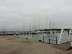
| Photo: Hamble
Quay, 05.12.17. |
|
|
|
|
|
 |
|
| Monday 4 |
21.23
mi |
34.17
km |
|
|
|
|
| Home to Warsash Village |
9.99
mi |
16.08
km |
|
| St Denys Road, Cobden Bridge,
Bullar Road, Bitterne Road, Northam
Bridge, Chapel, Itchen Bridge,
Portsmouth Road, Pound Road, Hamble
Lane, Lowford, Lower Swanwick
and Sarisbury Green. |
|
| Warsash Village to Warsash
Ferry |
2.18
mi |
3.51
km |
|
| Down Newtown Road and Hook Park
Road, through the nature reserve
to the beach for a short break
and a drink. From there along
the river path to the Hamble ferry. |
|
| Hamble Quay to Royal Victoria
Country Park |
2.76
mi |
4.44
km |
|
| Up to Hamble Square and down
School Lane to Hamble Point. Along
Hamble Shore and across the country
park to the park cafe for a tea
break. |
|
| Royal Victoria Country
Park to Home |
6.30
mi |
10.14
km |
|
| Out to Netley village, then
Weston Shore, Woolston, Peartree,
Bitterne, Lances Hill, Bullar
Road, Cobden Bridge and St Denys
Road. |
|
| Photo: The
beach at Warsash, 04.12.17. |
|
|
|
|
|
 |
|
| Friday 1 |
14.40
mi |
23.17
km |
|
|
|
|
| Home to Hamble Square |
8.24
mi |
13.26
km |
|
| St Denys Road, Cobden Bridge,
Bullar Road, Bitterne Road, Northam
Bridge, Chapel, Itchen Bridge,
Woolston, Weston Shore, Netley,
Royal Victoria Country Park, Hamble
Lane to Hamble Square. |
|
| Hamble Square to Royal
Victoria Country Park |
4.13
mi |
6.65
km |
|
| To Hamble Quay for a break,
then back up to the square, Hamble
Lane, Hound Road, Hound Way, Station
Road, Netley and the Royal Victoria
Country Park. |
|
| Royal Victoria Country
Park to Hamble Station |
2.03
mi |
3.27
km |
|
| A break at the park cafe, then
back to Netley, up Station Road
to the station, along the footpaths
to Hamble station for the train
home. |
|
| Photo: Hamble
Quay, 01.12.17. |
|
|
|
|
|
| More information and links |
|
|
|
|