|
|
|
 |
|
| Friday 23 |
11.58
mi |
18.64
mi |
|
|
|
|
| Poole (station) to Sandbanks |
5.46
mi |
8.79
km |
|
| Through the town centre to Poole
Quay, then Baiter Park, Whitecliff,
Lilliput, Evening Hill and promenade
to Sandbanks Pavillion and Sandbanks
Ferry. |
|
| Sandbanks to Bournemouth
(station) |
6.12
mi |
9.85
km |
|
| Along the beach to Branksome
Chine and the promenade to Bournemouth
Pier. A walk round the Lower Gardens
then up Bath Road to Lansdowne
Road, Park Road and Bournemouth
station. |
| |
| |
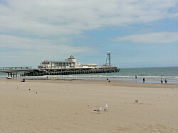
| Photo: Bournemouth
Pier 23.06.17. |
|
|
|
|
|
 |
|
| Thursday 22 |
6.84
mi |
11.01
mi |
|
|
|
|
| Christchurch (station)
to Mudeford Quay |
3.03
mi |
4.88
km |
|
| Through the town centre, High
Street, Castle Street, Bridge
Street, Purewell, Stanpit, Mudeford
Quay. |
|
| Mudeford Quay to Christchurch
(station) |
3.81
mi |
6.13
km |
|
| Mudeford Quay, Stanpit, Purewell,
Bridge Street, Castle Street,
Christchurch Castle, River Avon
footpath, Christchurch Town Quay,
River Avon footpath, Castle Street,
High Street, Station. |
|
|
|
| |
| |
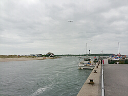
| Photo: Mudeford
Quay 22.06.17. |
|
|
|
|
|
 |
|
| Friday 16 |
11.26
mi |
18.12
km |
|
|
|
|
| Home to Winchester |
11.26
mi |
18.12
km |
|
| Via Portswood Road, High Road,
Stoneham Lane, Magpie Lane, Fleming
Park and Leigh Road to Woodside
Avenue (Eastleigh). |
|
| Along Woodside Avenue, then
through Allbrook, Highbridge,
Brambridge and Twyford to Hockley. |
|
| From Hockley, along the footpath
alongside the Itchen Navigation,
passing St Catherine's Hill to
Domum Road. Then via College walk
to regain the the river path at
The Weirs to Bridge Street and
The Broadway. |
| |
| |
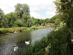
| Photo: The
Itchen Navigation just outside
Winchester 16.06.17. |
|
|
|
|
|
 |
|
| Thursday 15 |
11.46
mi |
18.44
km |
|
|
|
|
| Home to Hamble Square |
7.77
mi |
12.50
km |
|
| Along the river Itchen boardwalk,
under Northam bidge, through Chapel,
over the Itchen bridge to Woolston,
Weston Shore, Netley, the Royal
Victoria Country Park, Hamble
Lane and Hamble Square. |
|
| Hamble Square to Hamble
Station |
3.69
mi |
5.94
km |
|
| Down to Hamble Quay and back.
Along School Lane and the footpath
to Hamble Point. Along Hamble
Shore to the Royal Victoria Country
Park. After a break, Out to Hamble
Lane and down the Rail Trail footpath
to Hamble Station for the train
home. |
| |
| |
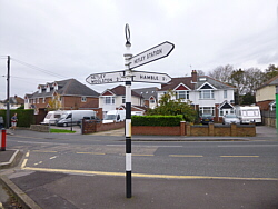
| Photo: Hamble
Quay 15.06.17. |
|
|
|
|
|
 |
|
| Wednesday 14 |
13.78
mi |
22.18
km |
|
|
|
|
| Havant to Hayling Island |
6.65
mi |
10.70
km |
|
| From Havant station by road
to Langstone Harbour. Over the
bridge to Hayling Island anf turn
on to the Hayling Billy Trail,
a coastal path following the former
railway line. From the end of
this path to by road Beachlands
and along the shore to Eastoke
Corner. |
|
| Hayling Island to Havant |
7.13
mi |
11.47
km |
|
| From Eastoke Corner back along
the shore to Beachlands and by
road to the Hayling Billy Trail.
Along the path, over the bridge
to Langstone and to Havant station
via the shopping precinct. |
| |
| |
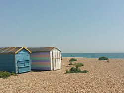
| Photo: The
beach between Beachlands and Eastoke
14.06.17. |
|
|
|
|
|
 |
|
| Tuesday 13 |
14.86
mi |
23.91
km |
|
|
|
|
| Home to Warsash Village |
9.54
mi |
15.35
km |
|
| Via the Itchen Boardwalk, under
Northam Bridge, Chapel, over the
Itchen Bridge, up Portsmouth Road,
through Old Netley, Lowford and
Sarisbury Green. |
|
| Warsash Village to Ferry |
1.01
mi |
1.63
km |
|
| Via Shore Road, Warsash Shore,
Passage Lane and the footpath. |
|
| Hamble Quay to Royal Victoria
Country Park |
2.21
mi |
3.56
km |
|
| From Hamble Quay up Green Lane,
through Hamble Common to Hamble
Point and along the shore to the
Royal Victoria Country Park. |
|
| Royal Victoria Country
Park to Hamble Station |
2.10
mi |
3.38
km |
|
| Out of the park to Netley village,
up Station Road then via Netley
station, The Badgers and the footpaths. |
| |
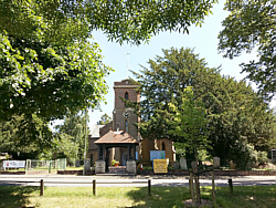
| Photo: Sarisbury
13.06.17. |
|
|
|
|
|
 |
|
| Sunday 4 |
*14.11
mi |
*22.71
km |
|
|
|
|
| City Centre (Bargate)
to Hamble Quay |
6.40
mi |
10.30
km |
|
| Via High Street, Briton Street,
Queen's Terrace, Canute Road,
Itchen Bridge, Woolston, Weston
Shore, Netley, Royal Victoria
Country Park, Hamble Lane, Hamble
Square. |
|
| Warsash Ferry to Warsash
Ferry |
2.81
mi |
4.52
km |
|
| Caught the ferry to Warsash.
Walked down the river to the beach
on Southampton Water, through
the nature reserve, up to the
village and back to the ferry. |
|
| Hamble Quay to Netley
Station |
4.90
mi |
7.89
km |
|
| From Hamble Quay up Green Lane,
down School Lane to Hamble Point
and along the shore to the Royal
Victoria Country Park for a break
at the cafe. From there, out to
Hamble Lane and Hamble station,
then down the footpaths to Netley
station. |
|
| *2.28 mi /
3.67 km from home to the city
centre not included here. |
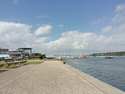
| Photo: Hamble
Quay 04.06.17. |
|
|
|
|
|
 |
|
| Saturday 3 |
16.72
mi |
26.91
km |
|
|
|
|
| Home to Warsash Village |
9.52
mi |
15.32
km |
|
| Via the Itchen Boardwalk, under
Northam Bridge, Chapel, over the
Itchen Bridge, up Portsmouth Road,
through Old Netley, Lowford and
Sarisbury Green. |
|
| Warsash Village to Ferry |
2.16
mi |
3.48
km |
|
| Down Newtown Road and Hook Park
Road, through the nature reserve
to the beach and then along the
river passing the Maritime College
and the Rising Sun. |
|
| Hamble Quay to Royal Victoria
Country Park |
2.84
mi |
4.57
km |
|
| After a break at Hamble Quay,
up to Hamble Square, down to Hamble
Point and along the shore to the
country park cafe for another
break. |
|
| Royal Victoria Country
Park to Netley Station |
2.20
mi |
3.54
km |
|
| Out to Hound Road then Hamble
Lane, Hamble station and the footpaths
to Netley station. |
| |
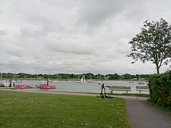
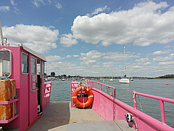
| Photo: The
pink ferry from Warsash to Hamble
03.06.17. |
|
|
|
|
|
 |
|
| Friday 2 |
12.85
mi |
20.68
km |
|
|
|
|
| Home to Hamble Square |
7.74
mi |
12.46
km |
|
| Along the river Itchen boardwalk,
under Northam bidge, through Chapel,
over the Itchen bridge to Woolston,
Weston Shore, Netley, the Royal
Victoria Country Park, Hamble
Lane and Hamble Square. |
|
| Hamble Square to Royal
Victoria Country Park |
2.93
mi |
4.72
km |
|
| Down to Hamble Quay and up Green
Lane to School Lane and Hamble
Point, along the shore to the
Royal Victoria Country Park. |
|
| Royal Victoria Country
Park to Netley Station |
2.18
mi |
3.51
km |
|
| Out to Hound Road then Hamble
Lane, Hamble station and the footpaths
to Netley station. |
| |
| Photo: Hamble
Quay 02.06.17. |
|
|
|
|
|
| More information and links |
|
|
|