|
|
|
 |
|
|
| |
|
|
|
| |
S |
M |
T |
W |
T |
F |
S |
|
| |
|
|
| |
1 |
2 |
3 |
4 |
|
|
| |
5 |
6 |
7 |
8 |
9 |
10 |
11 |
|
|
| |
12 |
13 |
14 |
15 |
16 |
17 |
18 |
|
|
| |
19 |
20 |
21 |
22 |
23 |
24 |
25 |
|
|
| |
26 |
27 |
28 |
29 |
30 |
31 |
|
|
| |
|
|
| |
|
|
|
|
|
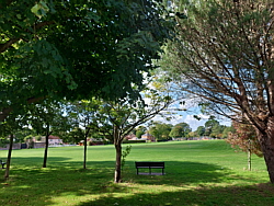
| Some of the places I've
walked for exercise and leisure this
month. |
| Places featured in the Walking Routes
pages plus selected other walks. |
|
|
| Last
Year |
Last
Month |
Next
Month |
Next
Year |
|
|
|
|
|
| More photos in the photo album |
|
|
|
|
|
|
|
|
 |
|
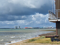
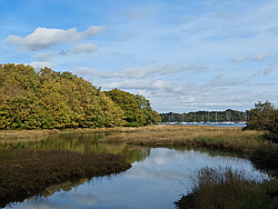
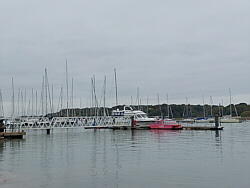
| Wednesday 1 October |
| Photo: Southampton Water, Hook,
Warsash |
|
| From home via St Denys Road,
Cobden Bridge, Bitterne Park Triangle,
Bullar Road, Bitterne Road (Lances
Hill), Bitterne Shopping Precinct,
Bursledon Road, Le Marechal Avenue,
Bower's Drive, Hamble Lane, Jurd
Way, Portsmouth Road, Oak Hill,
Bridge Road, Swanwick Shore Road,
river path, marina, river path,
footpath, Shore Road waterfront
and river path to the beach. A
break there, then through Hook
local nature reserve, Hook Park
Road, Newtown Road, Shore Road,
Passage Lane and the footpath
to the ferry hard. 10.56mi 16.99km.
Ferry to Hamble. |
|
| A break at Hamble Quay then
via Green Lane, Hamble Common,
School Lane footpath, Hamble Point
car park and Hamble Shore to the
Royal Victoria Country Park. Round
the park to the café for
a break, sitting outside. From
there to Netley station via Hound
Road, footpath and The Badgers.
3.34mi 5.38km. Train home. |
|
| 13.90mi 22.37km. |
| A cloudy start but becoming
sunny and warm. |
|
|
 |
|
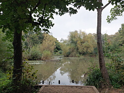
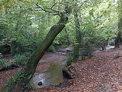
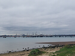
| Thursday 2 October |
| Photo: Shoreburs Greenway, Southampton |
|
| From home via St Denys Road,
Cobden Bridge, Bitterne Park Triangle,
Bullar Road, Bitterne Road (Lances
Hill), Peartree Avenue, Spring
Road, Shoreburs Greenway, Weston
Shore, footpath, Conker Field,
footpath, Abbey Hill, Victoria
Road, Royal Victoria Country Park,
Hamble Lane, High Street, Hamble
Quay. 8.63mi 13.89km. |
|
| A break at Hamble Quay then
via Green Lane, Hamble Common,
School Lane footpath, Hamble Common
and Hamble Shore to the Royal
Victoria Country Park. Round the
park to the café for a
break, sitting outside. From there
to Hamble station via Hound Road,
The Orchard, Hamble Rail Trail
footpaths and Hamble Lane. 3.86mi
6.21km. Train home. |
|
| 12.49mi 20.10km. |
| Cloudy for most of the walk,
some brightness later. A light
wind. |
|
|
 |
|
| Monday 6 October |
| Photo: River Hamble, from the
ferry |
|
| From home via St Denys (Horseshoe
Bridge), Itchen boardwalk and
river path, under Northam Bridge,
Princes Street, Millbank Street,
Belvidere Road, Marine Parade,
Albert Road North, Itchen Bridge,
Bridge Road, Portsmouth Road,
Lowford Hill, Portsmouth Road,
Oak Hill, Bridge Road, Barnes
Lane, Brook Lane, Newtown Road,
Strawberry Field, footpath to
Shore Road waterfront and the
footpath to the ferry pontoon.
10.23mi 16.46km. Ferry to Hamble. |
|
| A break with a drink at Hamble
Quay then via Hamble Square, High
Street, Hamble Lane, Ensign Way
and Hamble Shore to the Royal
Victoria Country Park. Round the
park and through the woods to
the café for a break, sitting
outside. From there to Hamble
station via Hound Road, The Orchard,
Hamble Rail Trail footpaths and
Hamble Lane. 3.78mi 6.08km. Train
home. |
|
| 14.01mi 22.55km. |
| Sunny and warm with a light
breeze. |
|
|
|
|
|
| |
 |
|
| Tuesday 7 October |
| Photo: Hamble Common |
|
| From home via St Denys (Horseshoe
Bridge), Itchen boardwalk and
river path, under Northam Bridge,
Princes Street, Millbank Street,
Belvidere Road, Marine Parade,
Albert Road North, Itchen Bridge,
Bridge Road, Portsmouth Road,
Botley Road, Bursledon Road, Kestrel
Park, Le Marechal Avenue, Bower's
Drive, Hamble Lane, High Street
and Hamble Square to Hamble Quay.
9.23mi 14.85km. |
|
| A break at Hamble Quay then
via Green Lane, Hamble Common,
School Lane footpath, Hamble Common
and Hamble Shore to the Royal
Victoria Country Park. Round the
park to the café for a
break, sitting outside. From there
to Hamble station via Hound Road,
The Orchard, Hamble Rail Trail
footpaths and Hamble Lane. 3.86mi
6.21km. Train home. |
|
| 13.09mi 21.07km. |
| Mostly sunny, a few clouds,
quite warm. |
|
|
 |
|
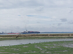
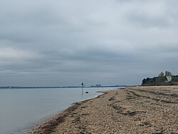
| Thursday 9 October |
| Photo: River Hamble, Warsash |
|
| From home via St Denys (Horseshoe
Bridge), Itchen boardwalk and
river path, under Northam Bridge,
Princes Street, Millbank Street,
Belvidere Road, Marine Parade,
Albert Road North, Itchen Bridge,
Bridge Road, Portsmouth Road,
Lowford Hill, Portsmouth Road,
Oak Hill, Bridge Road, Barnes
Lane, Brook Lane, Newtown Road,
Strawberry Field, footpath to
Shore Road waterfront and the
footpath to the ferry pontoon.
10.17mi 16.37km. Ferry to Hamble. |
|
| A break with a drink at Hamble
Quay then via Hamble Square, High
Street, Hamble Lane, Ensign Way
and Hamble Shore to the Royal
Victoria Country Park. Round the
park to the café for a
break, sitting outside. From there
to Hamble station via Hound Road,
The Orchard, Hamble Rail Trail
footpaths and Hamble Lane. 3.54mi
5.70km. Train home. |
|
| 13.71mi 22.06km. |
| Sunny and warm with a light
breeze. |
|
|
 |
|
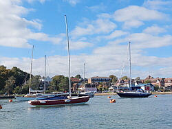
| Friday 10 October |
| Photo: Hamble Quay |
|
| From home via St Denys (Horseshoe
Bridge), Itchen boardwalk and
river path, under Northam Bridge,
Princes Street, Millbank Street,
Belvidere Road, Marine Parade,
Albert Road North, Itchen Bridge,
Bridge Road, Victoria Road, Weston
Shore, Weston Parade, footpath,
Conker Field, footpath, Victoria
Road, Royal Victoria Country Park,
Hamble Lane, High Street, Hamble
Square to Hamble Quay. 8.10mi
13.04km. |
|
| A break at Hamble Quay then
via Green Lane, Hamble Common,
School Lane footpath, Hamble Point
car park and Hamble Shore to the
Royal Victoria Country Park. Round
the park to the café for
a break, sitting outside. From
there to Hamble station via Hound
Road, The Orchard, Hamble Rail
Trail footpaths and Hamble Lane.
4.03mi 6.49km. Train home. |
|
| 12.13mi 19.52km. |
| A very different day with a
cloudy sky and feeling cooler.
Hardly any breeze, so quite good
for walking. |
|
|
|
|
| |
 |
|
| Monday 13 October |
| Photo: Hamble Shore |
|
| From home via St Denys (Horseshoe
Bridge), Itchen boardwalk and
river path, under Northam Bridge,
Princes Street, Millbank Street,
Belvidere Road, Marine Parade,
Albert Road North, Itchen Bridge,
Bridge Road, Portsmouth Road,
Lowford Hill, Portsmouth Road,
Oak Hill, Bridge Road, Barnes
Lane, Brook Lane, Newtown Road,
Hook Park Road, Hook Local Nature
Reserve, beach, river path, Shore
Road waterfront and footpath to
the ferry hard. 11.76mi 18.93km.
Ferry to Hamble. |
|
| A break at Hamble Quay then
via Green Lane, Hamble Common,
School Lane footpath, Hamble Common
and Hamble Shore to the Royal
Victoria Country Park. Round the
park and through the woods to
the café for a break, sitting
outside. From there to Hamble
station via Hound Road, The Orchard,
Hamble Rail Trail footpaths and
Hamble Lane. 4.06mi 6.53km. Train
home. |
|
| 15.82mi 25.46km. |
| A cloudy day, feeling cool when
in the breeze. |
|
|
 |
|
| Wednesday 15 October |
| Photo: Hamble Shore |
|
| From home via St Denys (Horseshoe
Bridge), Itchen boardwalk and
river path, under Northam Bridge,
Princes Street, Millbank Street,
Belvidere Road, Marine Parade,
Albert Road North, Itchen Bridge,
Bridge Road, Portsmouth Road,
Pound Road, Hamble Lane, Satchell
Lane and Hamble Square to Hamble
Quay. 8.41mi 13.53km. |
|
| A break at Hamble Quay then
via Green Lane, Hamble Common,
School Lane footpath, Hamble Common
and Hamble Shore to the Royal
Victoria Country Park. Round the
park to the café for a
break, sitting outside. From there
to Hamble station via Hound Road,
The Orchard, Hamble Rail Trail
footpaths and Hamble Lane. 3.90mi
6.28km. Train home. |
|
| 12.31mi 19.81km. |
| Cloudy and chilly. |
|
|
|
|
|
|
|
|
|
|
| More information and links |
|
|
|
|
|